THIS SECTION IS CURRENTLY UNDER CONSTRUCTION
.
Soon you will be able to find visual; historical; and current information pertaining to each of the 7 Precincts under this section; including broad based proposals made for these geographical areas; information and guidelines for designers pertaining to the natural and urban systems - all of which unlock the potential to design a sequence of projects, which can be rolled out systematically; and which capture the full range of historical, cultural, heritage, social, ecological, economic, educational and place-making potentials associated with the city's water resource - in a holistic, integrated and coordinated manner.
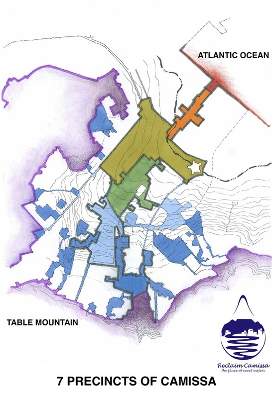
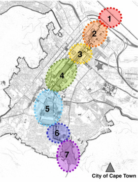
Meanwhile, for the purposes of understanding the systematic approach - we provide you herewith, a map as key to these 7 PRECINCTS.
More to follow, shortly...
PRECINCTS
These "precincts" have been defined after spatially mapping the geographical area from the perspective of 'a city within its region'; and the local area within the metropolitan area, in accordance with its natural systems; urban systems; transportation routes; public amenities; economic generators; building typologies - and then overlayed with a series of maps that examine how the city functions for its inhabitants and visitors, on a temporal spatial basis - i.e throughout the different seasons of Winter, Spring, Summer and Autumn - day or night.
What becomes evident, after many analysis maps, is this: There are seven distinct areas within the city bowl, that reflect the fundamental reason for the city's establishment - the ways in which water occurs; functioned previously; and could potentially function in the future of the city - if environmental principles are applied; and if we are to reclaim and use the water resources and their associated land parcels, to the benefit of the city and her inhabitants, optimally. Within each of these 7 PRECINCTS are numerous options for project proposals - which you will soon be able to find under this page. Map by Caron von Zeil.
LEGEND to the main 7 PRECINCTS along the spine of CAMISSA
|
© COPYRIGHT
ALL RIGHTS ARE RESERVED by THE RECLAIM CAMISSA TRUST No. IT 2882/2010.
The use of material on this page is permitted with acknowledgement of the source and prior written consent - contactable via [email protected]
All research, spatial framework and proposals are the intellectual property of Caron von Zeil.


